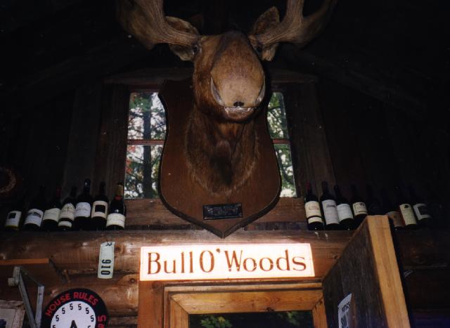
 It was raining in the morning so Matt and I started by arranging things
indoors. The colors were quite vivid inside the cabin, particularly the
reds.
It was raining in the morning so Matt and I started by arranging things
indoors. The colors were quite vivid inside the cabin, particularly the
reds.We made a fall excursion to The Cabin September 26 to October 1. Matt and I drove up late Sunday night (Sept 26). We would have arrived before midnight except for the large herd of deer we encountered on M77 north of Seney slowed us down quite a bit. The weather was good until we arrived. Then it started raining. The cabin was in pretty good shape when we got there (thanks to Vittoria and Phil for cleaning up the mess a few weeks earlier).
It was raining in the morning so Matt and I started by arranging things
indoors. The colors were quite vivid inside the cabin, particularly the
reds.
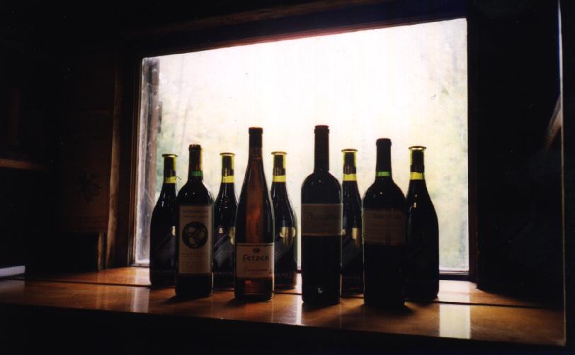
 We also did a bit of cleaning. In particular we rearranged the wine
bottles from previous years. They are now anchored by the Chateaux
Margaux on the right and the Moet on the left. We removed a duplicate
and also got rid of some of the other bottles that had taken on another
role and not just being used for display purposes any longer (we will
skip the gory details).
We also did a bit of cleaning. In particular we rearranged the wine
bottles from previous years. They are now anchored by the Chateaux
Margaux on the right and the Moet on the left. We removed a duplicate
and also got rid of some of the other bottles that had taken on another
role and not just being used for display purposes any longer (we will
skip the gory details).
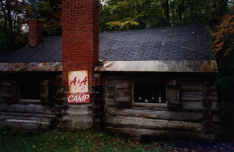 The weather cleared a bit so we prepared to head out for some excitement
Here is a picture of the main part of the cabin from the outside (hmm,
there is the wine again...). Matt and I headed into town for lunch
(buffalo burgers) after this.
The weather cleared a bit so we prepared to head out for some excitement
Here is a picture of the main part of the cabin from the outside (hmm,
there is the wine again...). Matt and I headed into town for lunch
(buffalo burgers) after this.
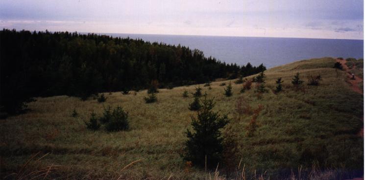
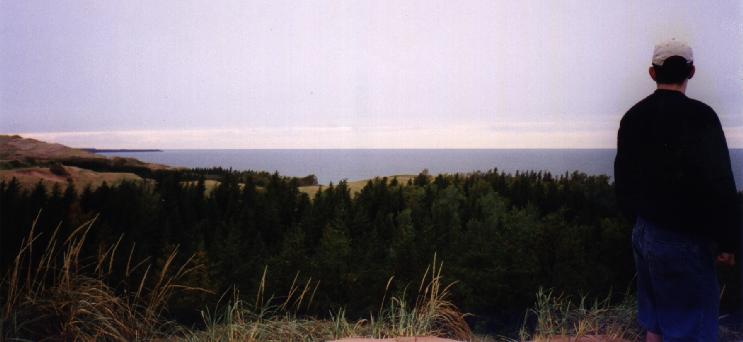
We drove out to the Grand Sable Dunes (eastern edge of Pictured Rocks National Lakeshore, just west of Grand Marais). It was still overcast but the scenery was great. We began by climbing around on the dunes overlooking Lake Superior.
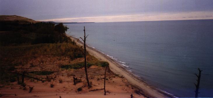
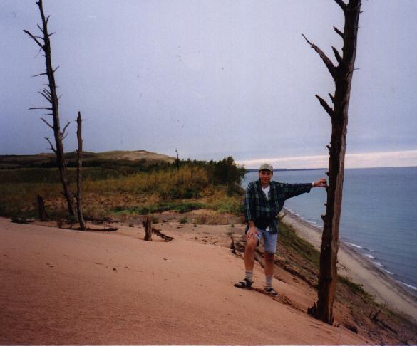
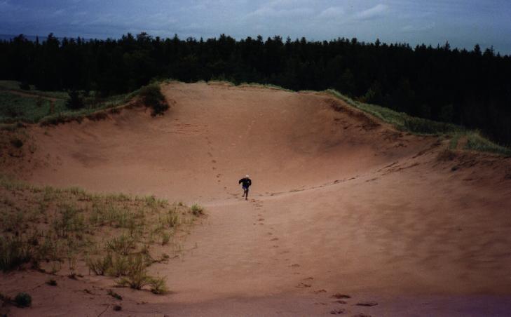
One thing we came across was a ghost forest. This is a forest (like the others seen in the pictures) that get buried in the shifting sands. A few thousand years later the sands shift back to uncover some still standing (but dead) trees. This forest was high above the beach which we climbed down to (ok, a mostly controlled descent). Which also meant we had a ``fun'' climb back up.
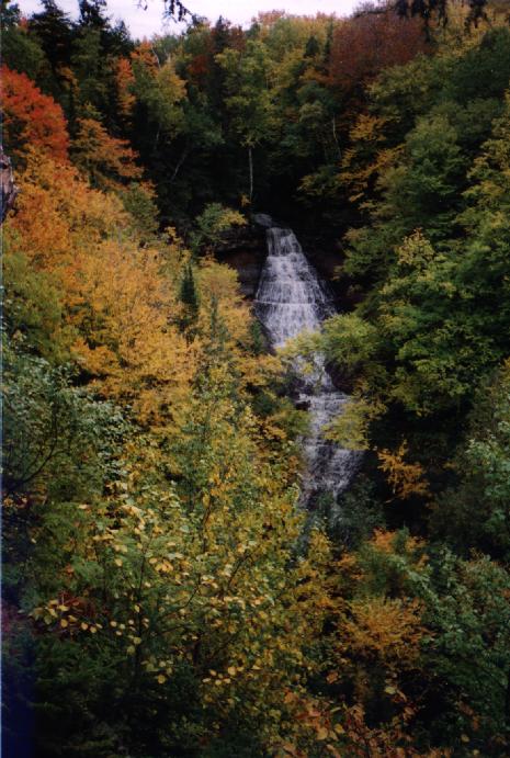
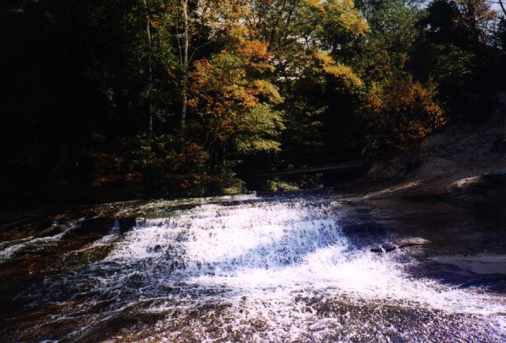
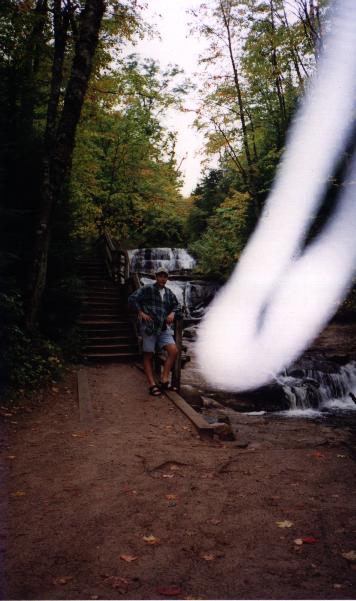 On the way back we stopped at the Grand Sable Falls. It is a small, but
multi-tiered waterfall.
On the way back we stopped at the Grand Sable Falls. It is a small, but
multi-tiered waterfall.
 Tuesday also started out overcast.
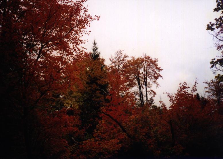
Matt and I took a short walk on a trail around the cabin. The
colors were too nice to ignore so I had to take a picture of
some of then we encountered. Even against a gray sky they are
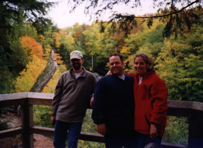
impressive. Jon, Amelia, Frank, and Rosie also arrived today
(shortly after noon). Naturally Neputo felt right at home and
kept himself comfortable while he was at the cabin. We had
dinner at the cabin, then, after they left, Carlo struck....
Tuesday also started out overcast.
Matt and I took a short walk on a trail around the cabin. The
colors were too nice to ignore so I had to take a picture of
some of then we encountered. Even against a gray sky they are
impressive. Jon, Amelia, Frank, and Rosie also arrived today
(shortly after noon). Naturally Neputo felt right at home and
kept himself comfortable while he was at the cabin. We had
dinner at the cabin, then, after they left, Carlo struck....
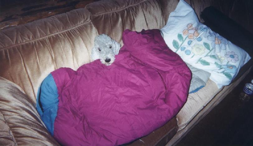
 Carlo stayed around for quite awhile. In fact, it is amazing (and
scary), that were eventually able to get rid of Carlo. Not that we
didn't appreciate Carlo. In fact, as can be seen in the picture,
Carlo was much beloved (at least by Amelia and Jon).
Carlo stayed around for quite awhile. In fact, it is amazing (and
scary), that were eventually able to get rid of Carlo. Not that we
didn't appreciate Carlo. In fact, as can be seen in the picture,
Carlo was much beloved (at least by Amelia and Jon).
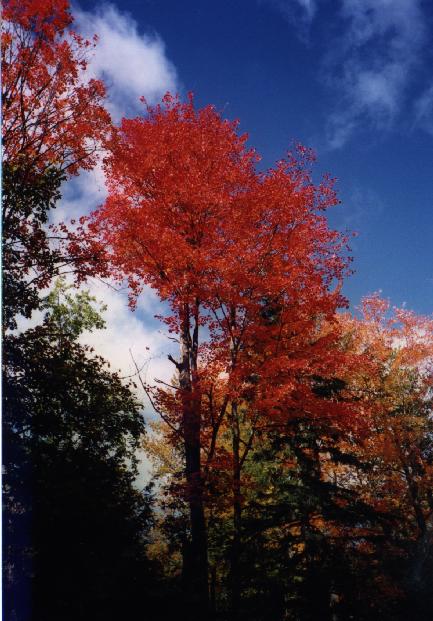
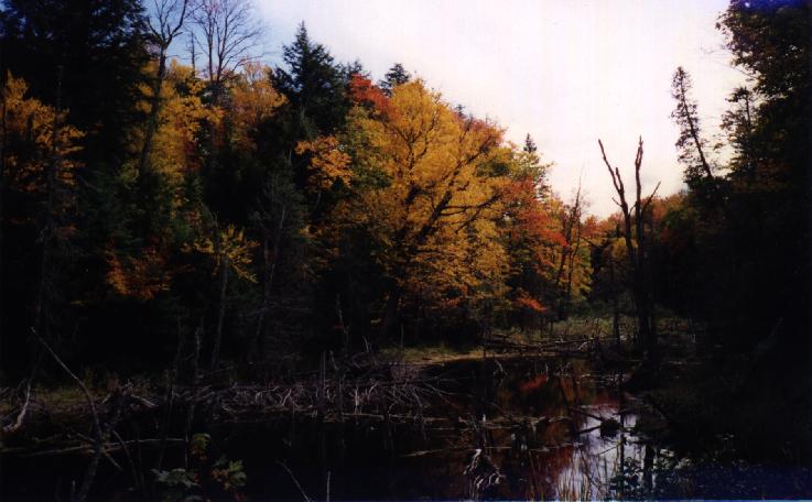
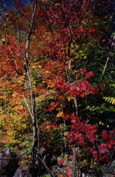
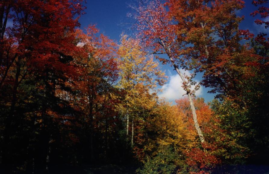 Matt and I managed to survive Carlo and went out for a bike ride.
Fortunately it was a sunny (partly cloudy) day. This made the colors we
encountered even more stunning. Before we started I got a couple of
pictures of the trees just outside the cabin. The colors set off quite
well in the sunlight against the blue sky. This was just a precursor to
the incredible scenery we were about to encounter.
Matt and I managed to survive Carlo and went out for a bike ride.
Fortunately it was a sunny (partly cloudy) day. This made the colors we
encountered even more stunning. Before we started I got a couple of
pictures of the trees just outside the cabin. The colors set off quite
well in the sunlight against the blue sky. This was just a precursor to
the incredible scenery we were about to encounter.
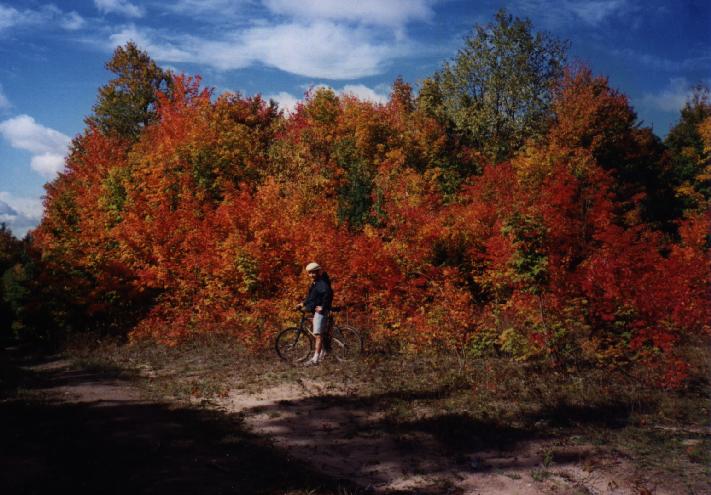
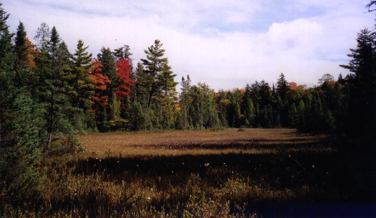
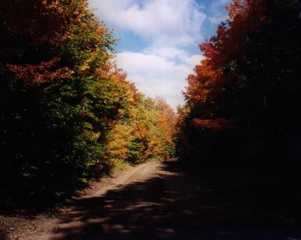
 The roads were still a bit wet and rather sandy. The ride started out
along McCloud grade past the Lucky Buck and went down hill
quickly. Fortunately the scenery was stunning and the weather held. We
came across many "photo ops" on the trip. In the beginning we were
stopping frequently.
The roads were still a bit wet and rather sandy. The ride started out
along McCloud grade past the Lucky Buck and went down hill
quickly. Fortunately the scenery was stunning and the weather held. We
came across many "photo ops" on the trip. In the beginning we were
stopping frequently.
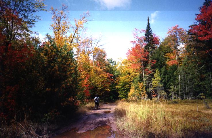
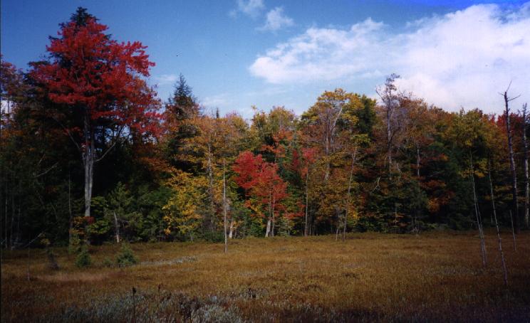
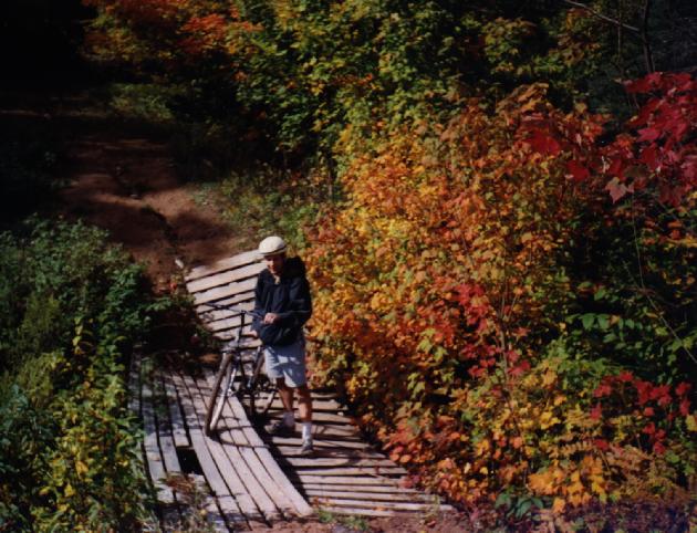
As we continued on we came across many impressive sights that needed to be photographed. Unfortunately, we will probably never be able to find them again. It was getting late and we only had a vague idea of where we were. Fortunately we had plenty of food and water and a GPS. We would stop periodically and verify that we were in general going in the right direction. However the distance from the cabin kept getting larger. The problem was that the roads winded so much even though at each intersection we picked the road that pointed in roughly the right direction, it would end up leading use further and further away. We were starting to get tired so we didn't stop for pictures as frequently.
 Finally we
made it back to some place we recognized. For those of you who
care it was the intersection of Old Seney Road and one of the
county roads where Old Seney turns to the right heading into
M77. It is pretty far south of where we started and we don't
really know how we got to this point. This is why we will never
be able to find the great places pictured above. Unfortunately
we were still quite far from the cabin and Matt was getting
sore. Fortunately we knew where we were so all we had to do was
take it slow and steady back to the cabin.
Finally we
made it back to some place we recognized. For those of you who
care it was the intersection of Old Seney Road and one of the
county roads where Old Seney turns to the right heading into
M77. It is pretty far south of where we started and we don't
really know how we got to this point. This is why we will never
be able to find the great places pictured above. Unfortunately
we were still quite far from the cabin and Matt was getting
sore. Fortunately we knew where we were so all we had to do was
take it slow and steady back to the cabin.
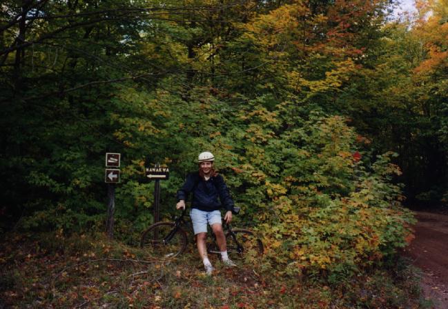 Finally we made it up to the turn off for Lake Nawakwa. We
didn't dare go down the road since we were already pretty tired
and still had a few miles to go (including a few big hills).
However we were close and knew that we would be back at the
cabin soon. It was a few more miles after this that we finally
pulled in to the cabin. We had been out for about 5 hours and
had covered over 20 miles on a sandy roads. Not bad for a day's
work. For dinner we went into town for pizza at the Dunes
Saloon to officially celebrate Frank's birthday.
Finally we made it up to the turn off for Lake Nawakwa. We
didn't dare go down the road since we were already pretty tired
and still had a few miles to go (including a few big hills).
However we were close and knew that we would be back at the
cabin soon. It was a few more miles after this that we finally
pulled in to the cabin. We had been out for about 5 hours and
had covered over 20 miles on a sandy roads. Not bad for a day's
work. For dinner we went into town for pizza at the Dunes
Saloon to officially celebrate Frank's birthday.
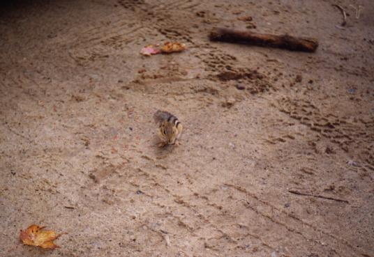 The next day Matt, Jon, Amelia, and I decided to head out to Chapel
Beach. This on the western side of Pictured Rocks (closer to Munising).
The day was cool and overcast with a strong threat of rain, but we went
anyway. In the parking lot we encountered a rather brave
chipmunk picking up bits of an apple someone had left
behind.
The next day Matt, Jon, Amelia, and I decided to head out to Chapel
Beach. This on the western side of Pictured Rocks (closer to Munising).
The day was cool and overcast with a strong threat of rain, but we went
anyway. In the parking lot we encountered a rather brave
chipmunk picking up bits of an apple someone had left
behind.
 Our first stop along the way was Chapel Falls. Here is a picture of
Matt, Jon, and Amelia with the falls in the background. A better
picture of the falls can be seen on the right. The signs claimed that
the falls were only about a 1.5 mile hike; it was a rather long 1.5
miles (maybe that was as the crow flies).
Our first stop along the way was Chapel Falls. Here is a picture of
Matt, Jon, and Amelia with the falls in the background. A better
picture of the falls can be seen on the right. The signs claimed that
the falls were only about a 1.5 mile hike; it was a rather long 1.5
miles (maybe that was as the crow flies).
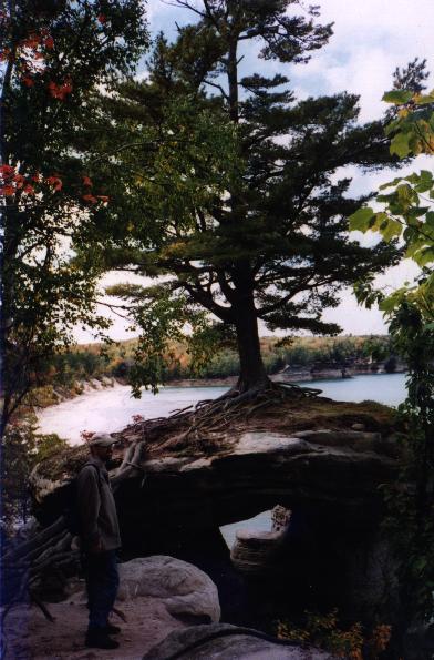
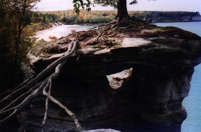
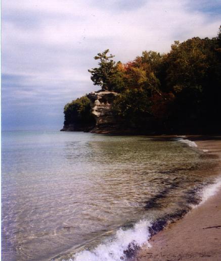
After this we were off to Chapel Rock. The rock was an impressive, natural structure. The rock itself had been eroded away leaving the center open with a few "pillars" to support it, much like a chapel I guess (hence the name). Interestingly there was a large pine tree growing on top of it; someplace you would never expect to find a tree. In the first picture Matt is present which gives an idea of the size of the structure and the tree. In the middle picture a closeup of Chapel Rock is shown. Here you can see some roots that span the gap between the top of the rock and the "main land". There used to be a rock bridge here that the roots followed over. The rock bridge has long since eroded away. In the final picture Chapel rock is shown from the beach down below (which can be seen in the background of the previous pictures).
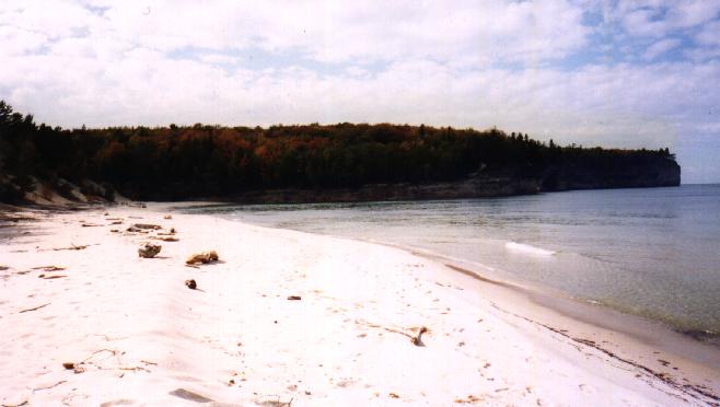
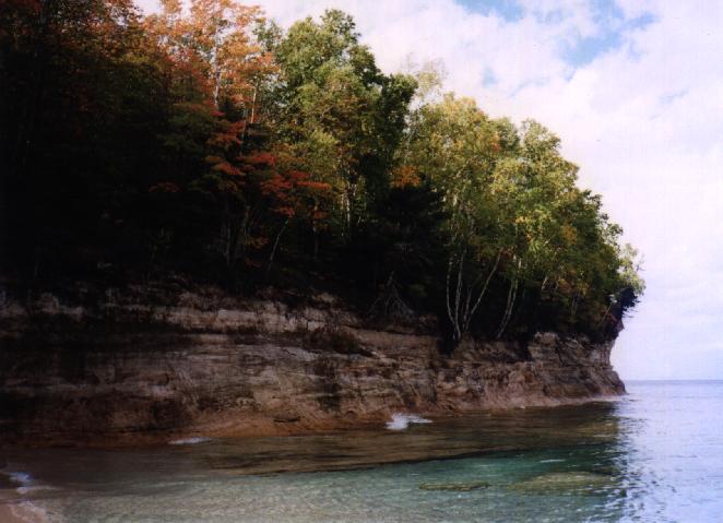
We finally made it down to the beach. The weather cleared up a bit while we were there. In fact, the sun came out for extended periods while we had lunch on the beach. I was very tempted to go for a swim in Lake Superior (even though it was very cold) but I hadn't come prepared for it so better judgment took over. In the first picture above the river (Chapel River?) can be seen flowing into the beach (and hence Lake Superior). The river is located near the base of Chapel Rock. The next picture shows Chapel Beach from near the mouth of the river. In the distance the cliffs that give the lakeshore its name can be seen. A closeup of them is shown in the following picture. The are more impressive in the direct sunlight. A number of trees that are holding on for dear life as they hang over the edge of the cliffs can be seen. In the final picture Matt, Amelia, and Jon can be seen on the beach as I look back towards Chapel Rock which can be seen in the distance.
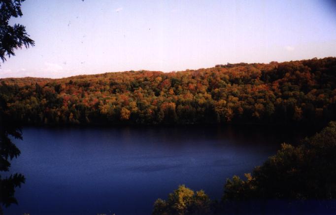 On the way back to the car we took a slightly different path. It was a
bit more scenic (including this nice looking lake). Shortly after this
picture dark clouds started to roll in quickly and heard thunder in the
distance. As we got close to the parking lot the wind picked up, we
heard thunder more frequently, and it was clear they skies were about to
open up. Matt and I made it back just as it started to rain. Jon and
Amelia came in a few minutes later.
On the way back to the car we took a slightly different path. It was a
bit more scenic (including this nice looking lake). Shortly after this
picture dark clouds started to roll in quickly and heard thunder in the
distance. As we got close to the parking lot the wind picked up, we
heard thunder more frequently, and it was clear they skies were about to
open up. Matt and I made it back just as it started to rain. Jon and
Amelia came in a few minutes later.
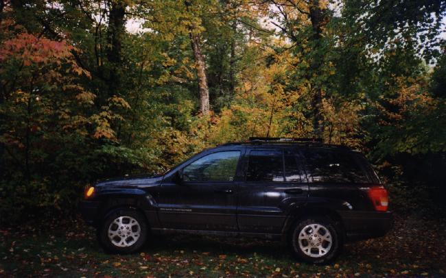
 It finally came time to head home. Matt and I took off very early (about
8:30am) and left Jon and Amelia behind to clean up and close up the
cabin. Matt's Jeep was pretty well covered with mud (inside and out)
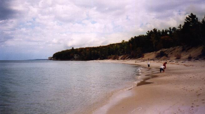
after being in the woods for this long. On the way back along the beach
(north shore of Lake Michigan) we saw a bald eagle flying low over the
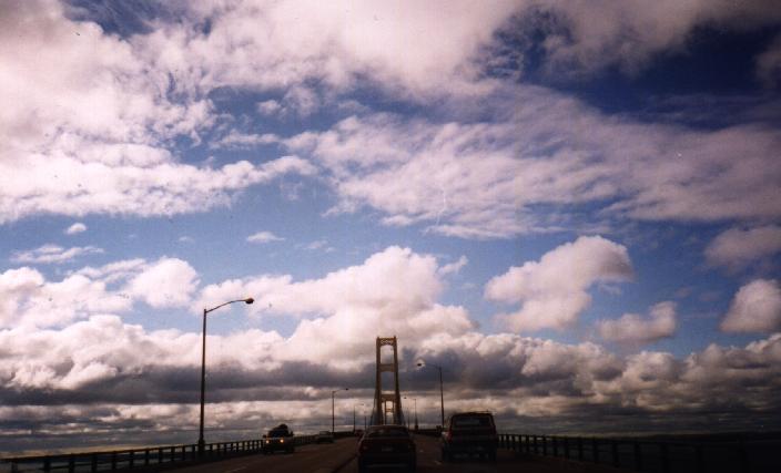
sand and waves. Shortly after this we crossed over the Mackinaw Bridge
and headed back to the Lower Peninsula.
It finally came time to head home. Matt and I took off very early (about
8:30am) and left Jon and Amelia behind to clean up and close up the
cabin. Matt's Jeep was pretty well covered with mud (inside and out)
after being in the woods for this long. On the way back along the beach
(north shore of Lake Michigan) we saw a bald eagle flying low over the
sand and waves. Shortly after this we crossed over the Mackinaw Bridge
and headed back to the Lower Peninsula.
All in all it was another great trip, though too short as usual. We had 2 cords of wood dropped off and ordered four more. We shouldn't run out of wood this winter when we go up. We also ordered two tanks of propane. Hopefully we won't run out of gas either. Finally we left behind a lot of food. We should be all set for 1 or 2 or ... trips up this winter.
Copyright © 1999, Craig J Copi. The photos on this page cannot be used without the express consent of Craig J Copi.
![]()
Valid HTML 4.01 (Transitional)